
I. Dataset content features
i. Abstract
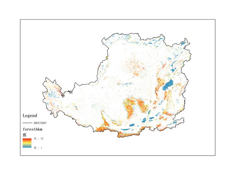
The datasets are remote-sensing data on the resources and environment of the Loess Plateau, and mainly record data on soil erosion, land use, land resources, soil, forest resources, vegetation, and grassland resources from 1987 to 1990. They are collected and organized by Institute of Geographic Sciences and Natural Resources Research, Chinese Academy of Sciences, and include Erosion Map (1987-1990), Land Use Map (1987-1990), Land Resource Map (1987-1990), Soil Map (1987-1990), Forest Map (1987-1990), Vegetation Map (1987-1990), Grassland resources map (1987-1990). There are totally 7 data files in .adf format. They can be used to study the changes in resources and the environment in the Loess Plateau, and government decision-making.
ii. Elements (content fields)
The datasets are named as “Remote Sensing Series of Loess Plateau Resources and Environment from 1987 to 1990”, which include 7 data files. There are mainly 7 data name and they are described as table 1.
| Data name | Item(field) | Field name in chinese | Field measure unit | Field code description | Remarks |
|---|---|---|---|---|---|
| Soil erosion | Soil erosion intensity | 土壤侵蚀强度 | power level | ||
| Land use | Land use type | 土地利用类型 | |||
| Land resources | Land resource type | 土地资源类型 | |||
| Soil | Soil type | 土壤类型 | |||
| Forest | Forest type | 森林类型 | |||
| Vegetation | Vegetation type | 植被类型 | |||
| Grassland resources | Grassland resources type | 草地资源类型 |
iii. Temporal cover
Time of the dataset from 1987 to 1990.
iv. Spatial cover
The datasets cover all of Loess Plateau.
II. Subject/industry scope of dataset/atlas
i. Subject scope
Earth Science, environmental sciences, regional sustainable development, geography.
ii. Industry scope
Resource and environmental monitoring.
iii. Other classifications (optional)
III. Accuracy of dataset/atlas
i. Time frequency
Yearly
ii. Spatial reference, accuracy, and granularity
The spatial reference of the dataset is albers_conic_equal_area, the minimal granularity of the dataset is 500m.
IV. Dataset/atlas storage management
i. Data quantity
The volume of the dataset is 107.3 MB.
ii. Type format
The dataset is stored in hard disk with a format of ArcGIS GRIS.
iii. Update management
Unscheduled update.
V. Quality control of the dataset/atlas
i. Data sources (condition selection)
ii. Methods of the data acquisition and processing (condition selection)
Through correction, shear and exponential calculations, data are obtained to obtain remote sensing data of resources and environment in the Loess Plateau. Data processing software includes ArcGIS and ENVI. First, the acquired remote sensing data is corrected and processed. Then, we use ArcGIS for index calculation and classification. Finally, we add the above result to get the rasterized resource environment data.
VI. Sharing and usage method of the dataset/atlas
i. Sharing methods and restrictions
Full and open sharing.
ii. Contact information of the sharing service (condition selection)
Online link address:
Contact Information for Service:
Name: Yuan Yuelei
Address:11A, Datun Road, Chaoyang District, Beijing, 100101, China, Institute of Geographic Sciences and Natural Resources Research, CAS.
Zip Code:100101
E-mail: wdc-rre@lreis.ac.cn
iii. Conditions and methods of usage
The dataset can be read by ArcGIS software.
VII. Intellectual property rights of the dataset/atlas
i. Property rights (optional)
Intellectual property of the dataset belonged to Institute of Geographic Sciences and Natural Resources Research, CAS.
ii. Reference method of the dataset/atlas
Institute of Geographic Sciences and Natural Resources Research, Chinese Academy of Sciences. Remote Sensing Series of Loess Plateau Resources and Environment. Institute of Geographic Sciences and Natural Resources Research, Chinese Academy of Sciences [Establishment organization], 2007. World Data Center for Renewable Resources and Environment [Communication agency], 2017-3-4.
iii. Usage contacts of the datasets/atlas
Name: Yuan Yuelei
Address:11A, Datun Road, Chaoyang District, Beijing, 100101, China, Institute of Geographic Sciences and Natural Resources Research, CAS.
Zip Code:100101
E-mail:wdc-rre@lreis.ac.cn
VIII. Others (optional)
In addition to the above, other information must also be explained.
Data documentation author information |
|||
|---|---|---|---|
| Data documentation author | Wei Haishuo | Update time | 2017-3-31 |
| Organization | Institute of Geographic Sciences and Natural Resources Research, CAS | ||
| Contact information | |||
| Address | 11A, Datun Road, Chaoyang District, Beijing, 100101, China | Postcode | 100101 |
| Telephone | 010-64889048-8006 | wdc-rre@lreis.ac.cn | |
 Northeast Institute of Geography and Agroecology, Chinese Academy of Sciences