Toggle navigation
Home
Databases
Solid Earth
Human-nature Relationship
Terrestrial Surface
Atmosphere
Solar-Terrestrial Physics and Astronomy
Ocean
Cryosphere
Paleoenviron-ment
Others
Data Policy
WDC-RRE's mission and vision
Framwork and development strategy of WDC-RRE
WDC-RRE management and operating specification
Data storage specification
Data use statement of WDC-RRE
Rights and security of WDC-RRE data
Documents
Data processing handbook
WDC-RRE metadata standard
WDC-RRE data documentation
Data quality control specification of WDC-RRE
The specification of WDC-RRE data identification
WDC-RRE Database classification introduction
Experts committee of WDC-RRE
WDC-RRE user committee
The team for preserving and processing of WDC-RRE data
Catalogue Service
Pages
About
Introduction
Help
User
Recent use
Most use
My collection
Personal Data
GIS
Home
Document
GIS
GIS
Ecological statistics assessment and ecological safety database of China
jiuzhaigou
ecology
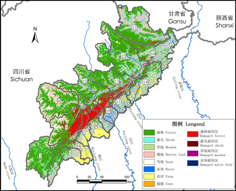
Description Data of ecosystem distribution before and after earthquake in Wenchuan earthquake area. Release institutions China Da......
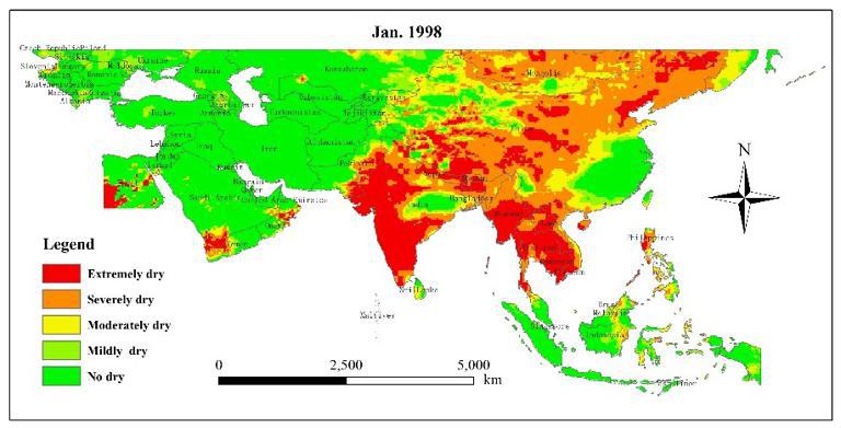
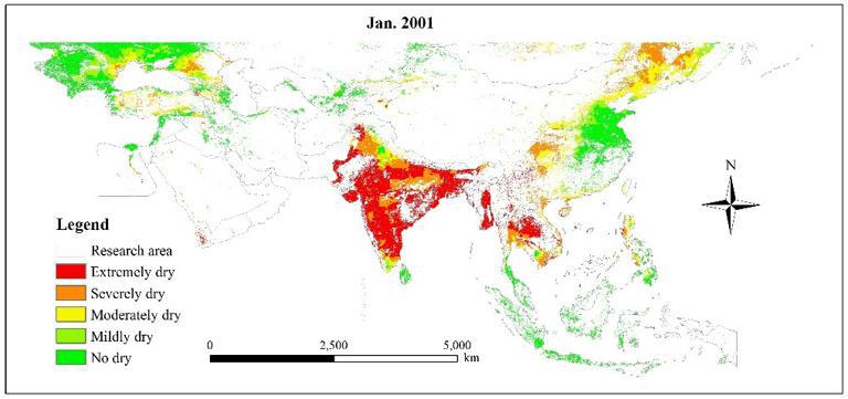
Spatio-temporal Distribution of Drought in the Belt and Road Area during 1998-2015 Based on TRMM Precipitation Data
spatio-temporal distribution
drought
the Belt and Road
Dataset content features Abstract Based on the Tropical Rainfall Measurement Satellite (TRMM) 3B43 precipitation data, we used the......
Drought levels in the cropland in Belt and Road area from 2001 to 2013
Belt and Road
drought levels
Dataset content features Abstract Based on the Tropical Rainfall Measurement Satellite (TRMM) 3B43 precipitation data, we used th......
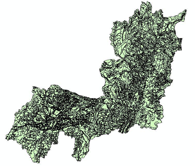
The geomorphology data of Songliao rivers basin
songliao
geomorphology
The data is the geomorphology data of Songliao basin. Songliao basin generally refers to the northeast of China. The administrativ......
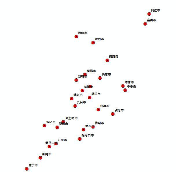
The county city of Songliao basin
songliao
county city
The data is the county level city of Songliao basin. Songliao basin generally refers to the northeast of China. The administrative......
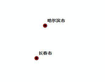
The provincial capital level city of Songliao basin
songliao
provincial capital
The data is the provincial capital level city of Songliao basin. Songliao basin generally refers to the northeast of China. The ad......
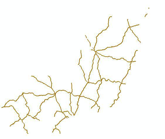
The highway of Songliao Basin
songliao
highway
The data is the highway of Songliao basin. Songliao basin generally refers to the northeast of China. The administrative divisions......
The national road of Songliao Basin
songliao
national road
The data is the national road of Songliao basin. Songliao basin generally refers to the northeast of China. The administrative div......
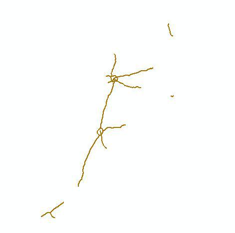
The provincial road of Songliao Basin
songliao
provincial road
The data is the provincial road of Songliao basin. Songliao basin generally refers to the northeast of China. The administrative d......
The 3rd and 4th grade river of Songliao basin
songliao
river
The data is the third and fourth grade river of Songliao basin. Songliao basin generally refers to the northeast of China. The adm......
1
2
Next page
End
Most attention
Spatio-temporal Distribution of Drought in the Belt and Road Area during 1998-2015 Based on TRMM Precipitation Data
Key members of the Scientific Committee
Drought levels in the cropland in Belt and Road area from 2001 to 2013
Knowledge Service for Disaster Risk Reduction: A Practice Using Big Data Technology
World Data System Asia-Oceania Conference 2019 Held in Beijing
Recent articles
Notice of International Training Workshop on Resource & Environment Scientific Data Sharing and Disaster Risk Reduction Knowledge Service along the Belt and Road
International Training Workshop on Resource & Environment Scientific Data Sharing and Disaster Risk Reduction Knowledge Service along the Belt and Road Held Online
World Data System Research Assistant Recruitment
Knowledge Service for Disaster Risk Reduction: A Practice Using Big Data Technology
Key members of the Scientific Committee
Classified catalogue
Remote Sensing
GIS
Programming and development
Software application
Open source GIS
Space Technology
GPS
Education and training
Application
Wetland ecology
Data
Resource download
Other
Image & Text
News
Generalization
Achievements
Documents
Introduction
Mission and Vision
Management and operation
Data process handbook
Data storage specification
Contact Us
11A, Datun Road, Chaoyang District, Beijing, 100101, China
+86 010-64889048-8006
wdc-rre@lreis.ac.cn
Sponsors
Institute of Geographic Sciences and Natural Resources Research, Chinese Academy of Sciences
Northeast Institute of Geography and Agroecology, Chinese Academy of Sciences
All rights reserved. © World Data Center for Renewable Resources and Environment, since 2014.


 Northeast Institute of Geography and Agroecology, Chinese Academy of Sciences