Toggle navigation
Home
Databases
Solid Earth
Human-nature Relationship
Terrestrial Surface
Atmosphere
Solar-Terrestrial Physics and Astronomy
Ocean
Cryosphere
Paleoenviron-ment
Others
Data Policy
WDC-RRE's mission and vision
Framwork and development strategy of WDC-RRE
WDC-RRE management and operating specification
Data storage specification
Data use statement of WDC-RRE
Rights and security of WDC-RRE data
Documents
Data processing handbook
WDC-RRE metadata standard
WDC-RRE data documentation
Data quality control specification of WDC-RRE
The specification of WDC-RRE data identification
WDC-RRE Database classification introduction
Experts committee of WDC-RRE
WDC-RRE user committee
The team for preserving and processing of WDC-RRE data
Catalogue Service
Pages
About
Introduction
Help
User
Recent use
Most use
My collection
Personal Data
Agricultural Resources
Home
Data
Agricultural Resources
Agricultural Resources
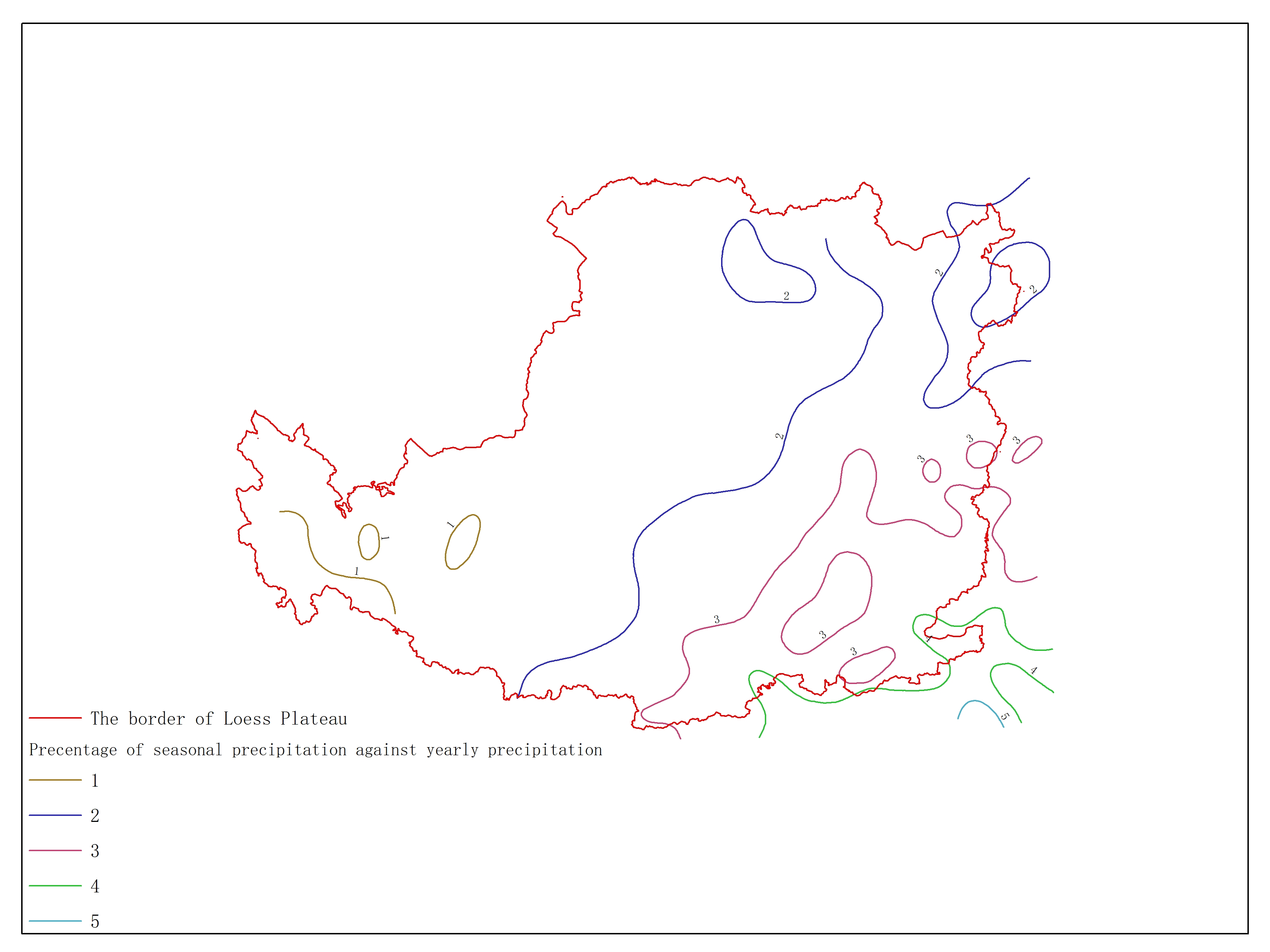
Agricultural climate resource atlas of Loess Plateau-Precentage of seasonal precipitation against yearly precipitation (December, January, February)
Loess Plateau
precipitation
The data set is Precentage of seasonal precipitation against yearly precipitation (December, January, February) of Loess Plateau a......
Agricultural climate resource atlas of Loess Plateau-Total solar radiation during ≥10℃ period
Loess Plateau
solar radiation
The data set is Total solar radiation during ≥10℃ period of Loess Plateau and the data format is a feature format. The data is pro......
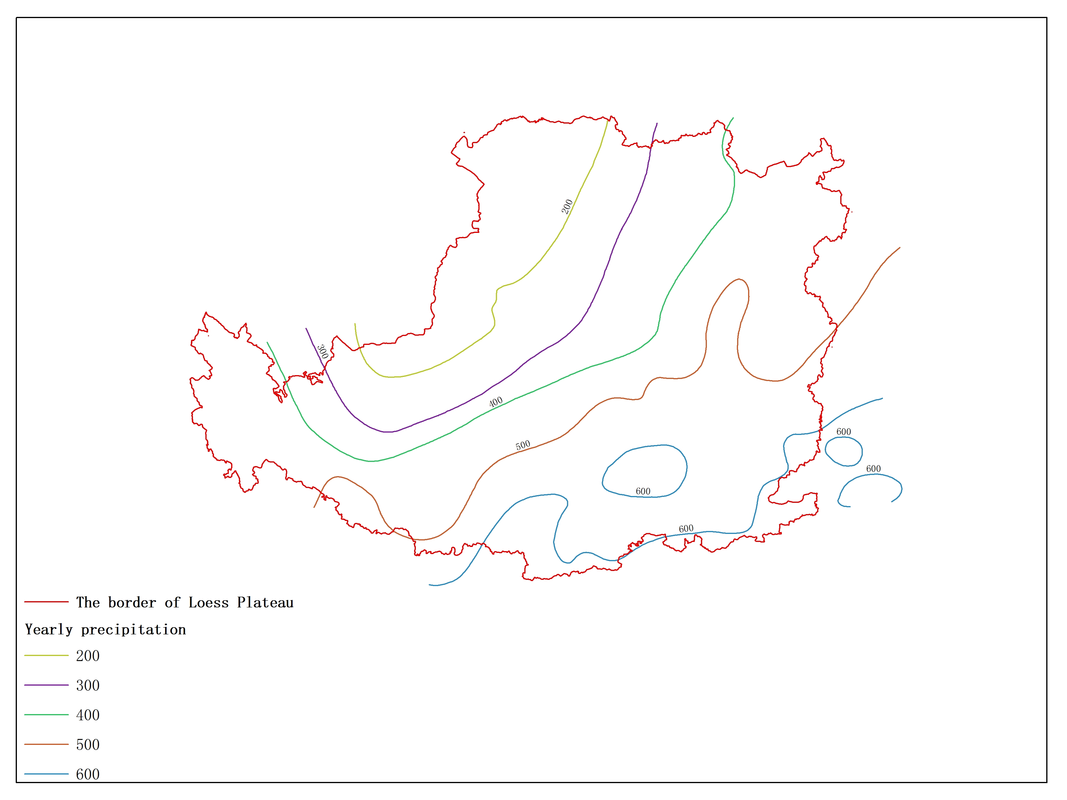
Agricultural climate resource atlas of Loess Plateau-Yearly precipitation
Loess Plateau
agricultural climate
The data set is Highest yield per unit area of Summer maize with seperated irrigaton of Loess Plateau and the data format is a fea......
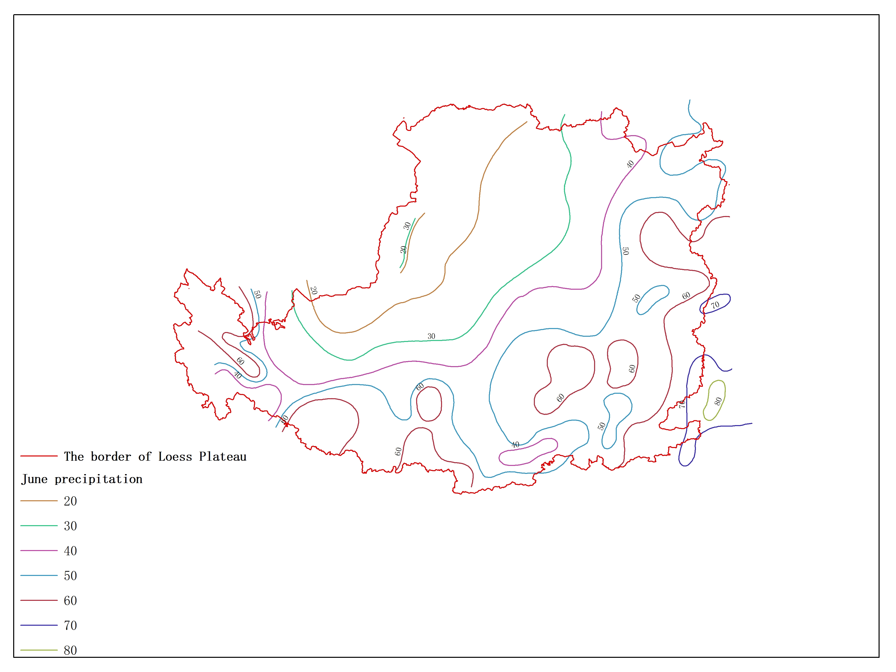
Agricultural climate resource atlas of Loess Plateau-June precipitation
Loess Plateau
agricultural climate
The data set is Largest unit of grazing (clover as an example) with natural precipitation of Loess Plateau and the data format is ......
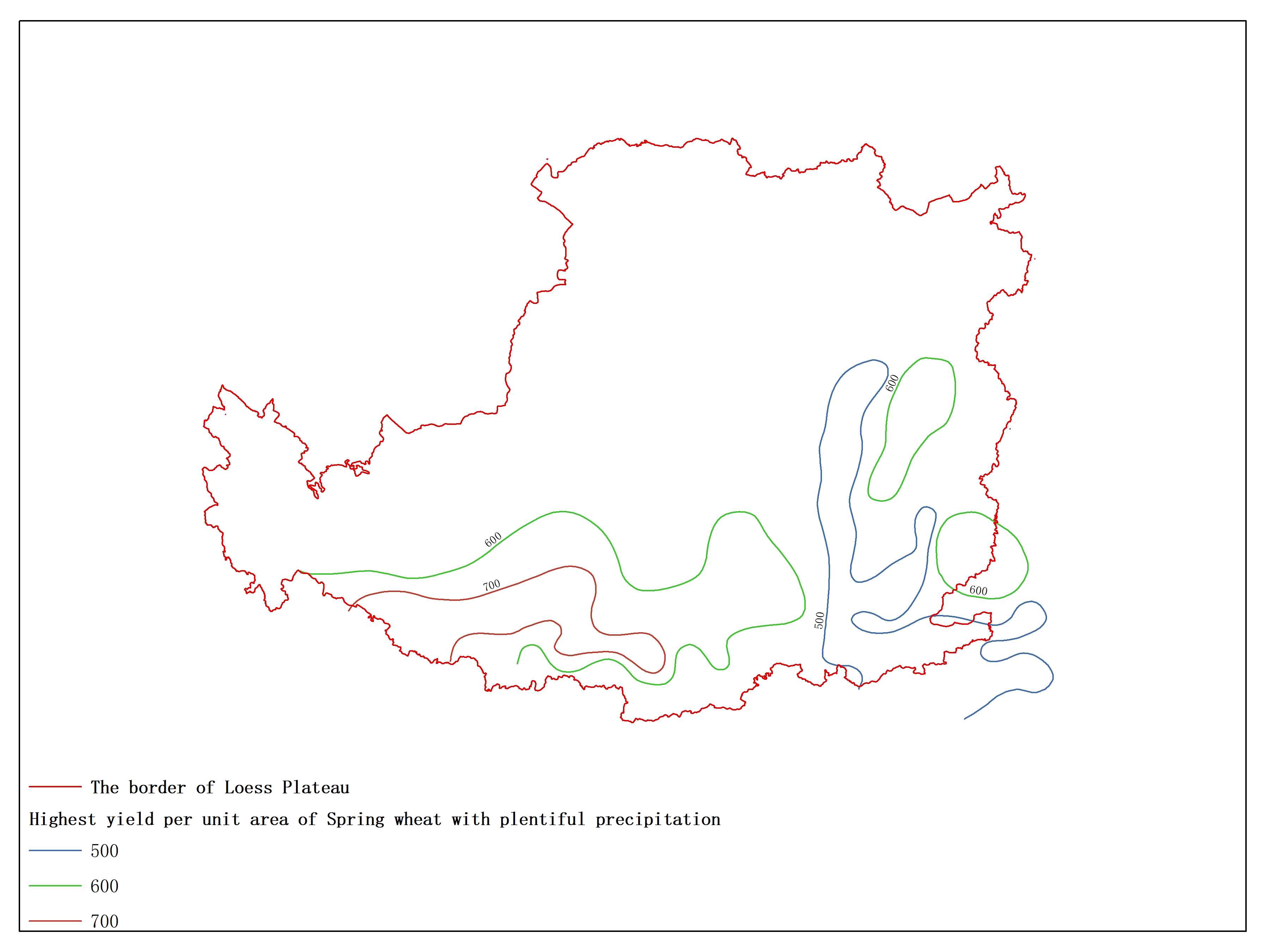
Agricultural climate resource atlas of Loess Plateau-Highest yield per unit area of Spring wheat with plentiful precipitation
Loess Plateau
yield
The data set is Duration during ≥5℃ period of Loess Plateau and the data format is a feature format. The data is processed by the ......
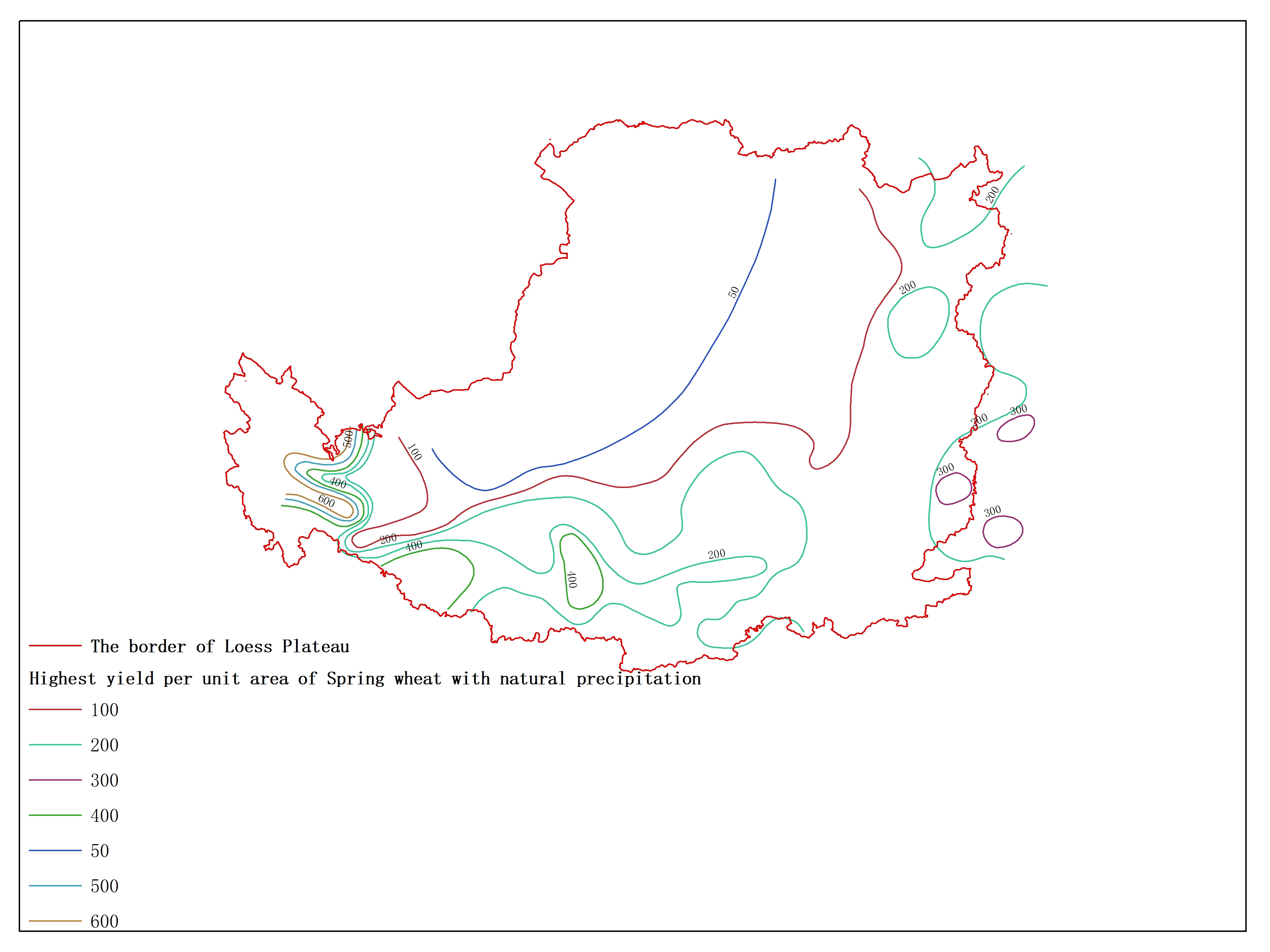
Agricultural climate resource atlas of Loess Plateau-Highest yield per unit area of Spring wheat with natural precipitation
Loess Plateau
agricultural climate
The data set is Highest yield per unit area of Spring wheat with natural precipitation of Loess Plateau and the data format is a f......
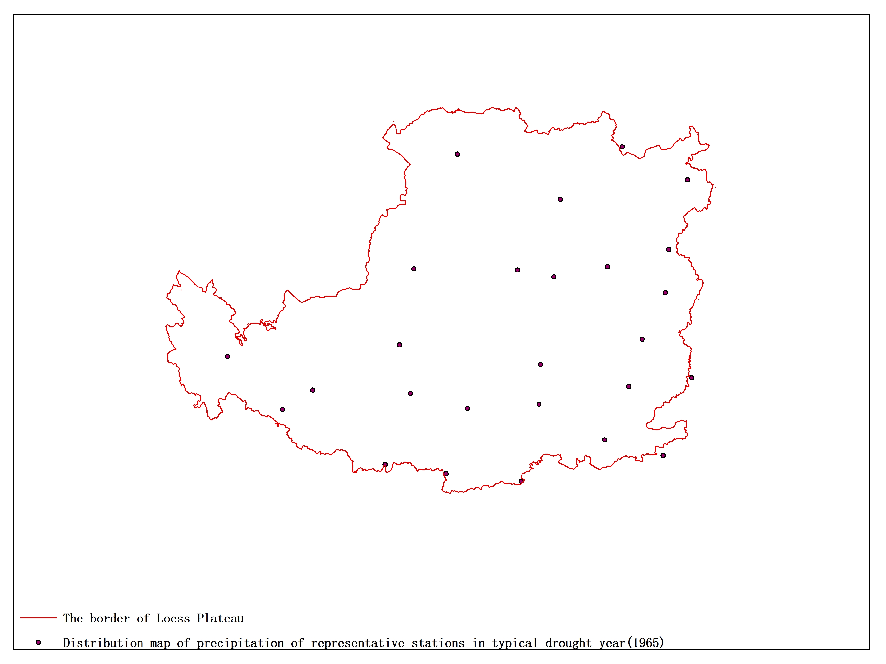
Agricultural climate resource atlas of Loess Plateau-Distribution map of precipitation of representative stations in typical drought year(1965)
Loess Plateau
agricultural climate
The data set is Distribution map of precipitation of representative stations in typical drought year(1965) of Loess Plateau and th......
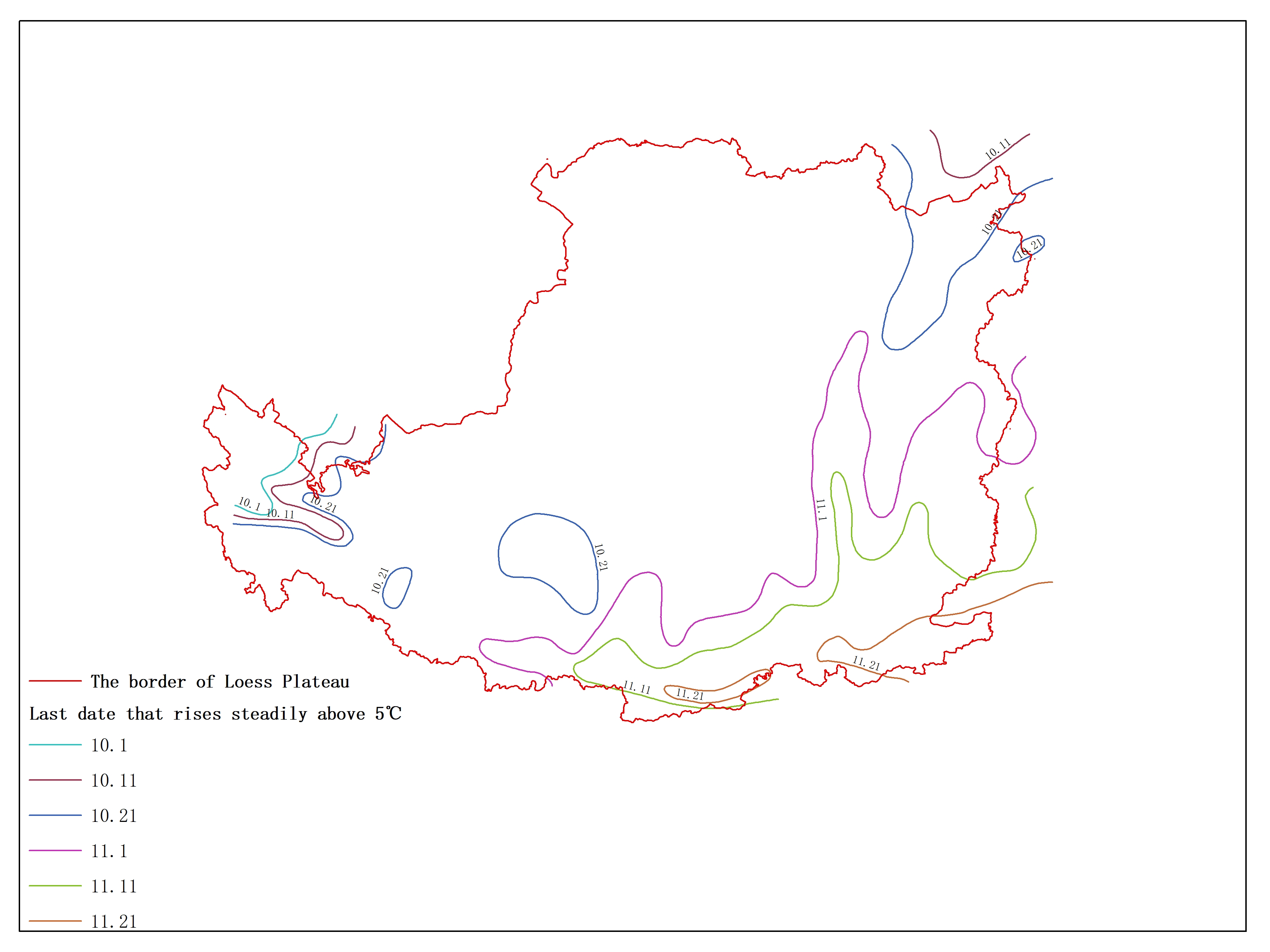
Agricultural climate resource atlas of Loess Plateau-Last date that rises steadily above 5℃
Loess Plateau
temperature
The data set is First date that rises steadily above 5℃ of Loess Plateau and the data format is a feature format. The data is proc......
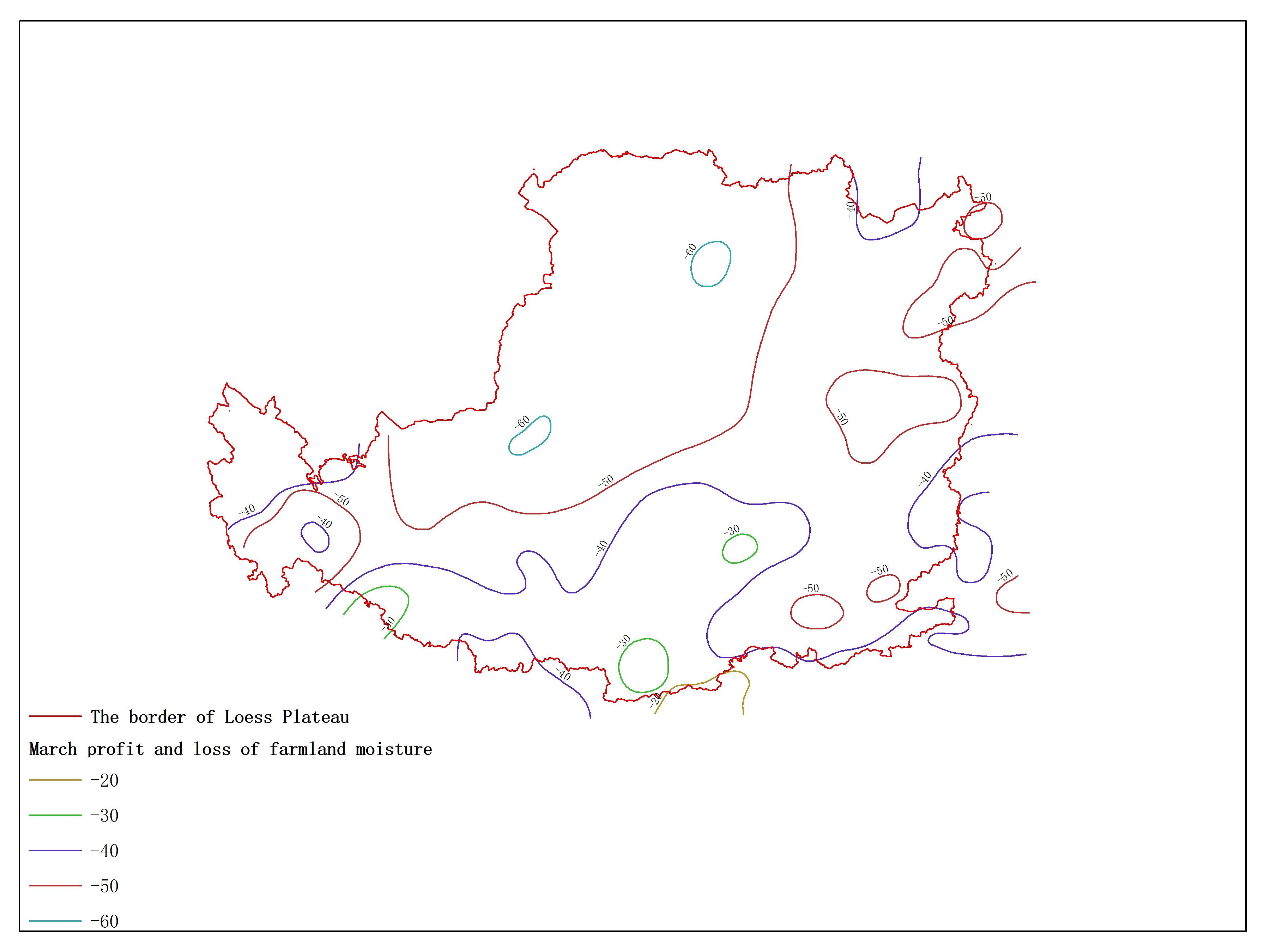
Agricultural climate resource atlas of Loess Plateau-March profit and loss of farmland moisture
Loess Plateau
agricultural climate
The data set is March profit and loss of farmland moisture of Loess Plateau and the data format is a feature format. The data is p......
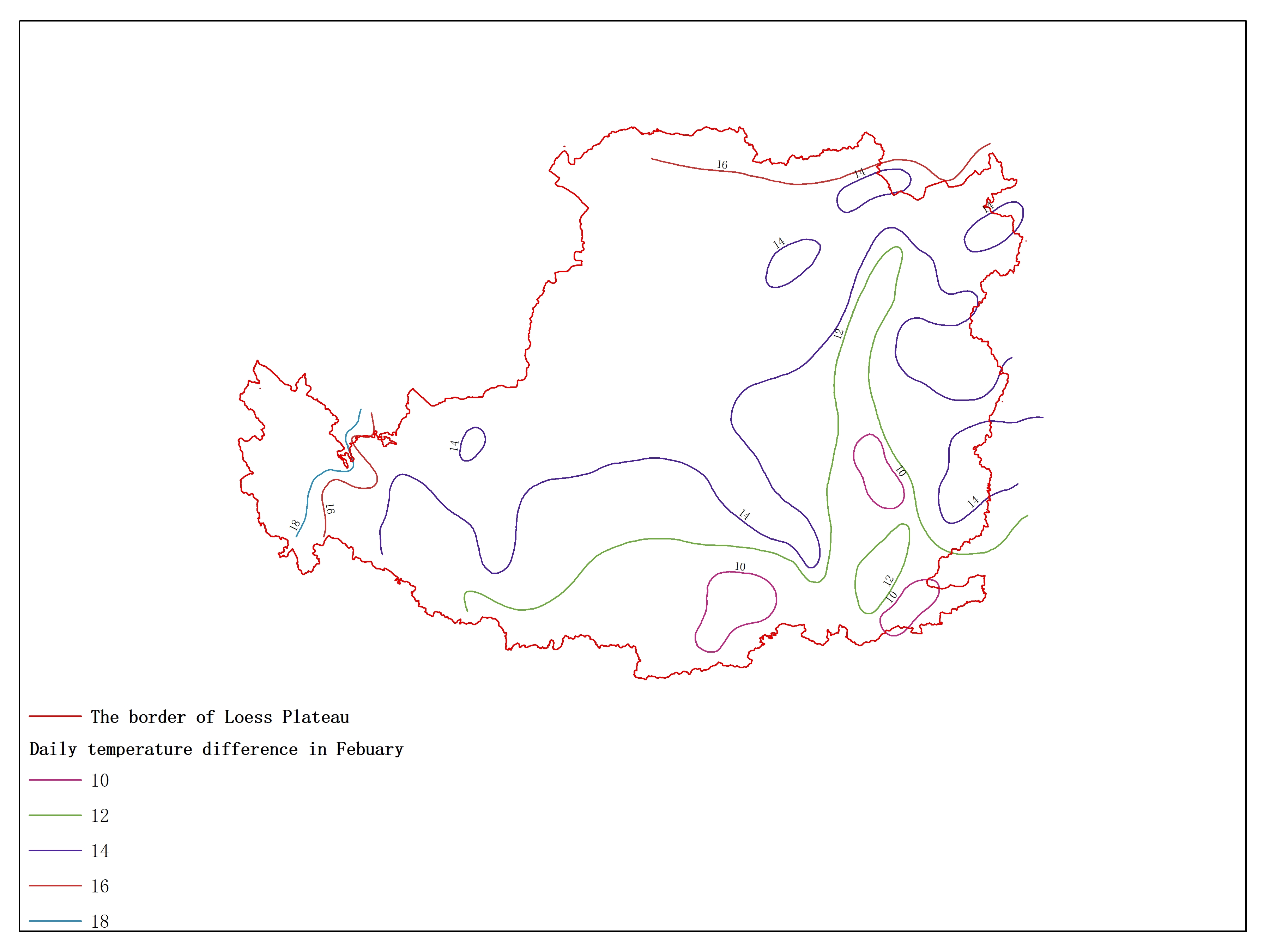
Agricultural climate resource atlas of Loess Plateau-Daily temperature difference in February
Loess Plateau
temperature
The data set is Daily temperature difference in Febuary of Loess Plateau and the data format is a feature format. The data is proc......
1
2
3
4
5
6
7
8
9
10
Next page
End
Most attention
Spatio-temporal Distribution of Drought in the Belt and Road Area during 1998-2015 Based on TRMM Precipitation Data
Drought levels in the cropland in Belt and Road area from 2001 to 2013
Key members of the Scientific Committee
World Data System Asia-Oceania Conference 2019 Held in Beijing
The county city of Songliao basin
Recent articles
Notice of International Training Workshop on Resource & Environment Scientific Data Sharing and Disaster Risk Reduction Knowledge Service along the Belt and Road
International Training Workshop on Resource & Environment Scientific Data Sharing and Disaster Risk Reduction Knowledge Service along the Belt and Road Held Online
World Data System Research Assistant Recruitment
Knowledge Service for Disaster Risk Reduction: A Practice Using Big Data Technology
Key members of the Scientific Committee
Classified catalogue
Remote Sensing
GIS
Programming and development
Software application
Open source GIS
Space Technology
GPS
Education and training
Application
Wetland ecology
Data
Resource download
Other
Image & Text
News
Generalization
Achievements
Documents
Introduction
Mission and Vision
Management and operation
Data process handbook
Data storage specification
Contact Us
11A, Datun Road, Chaoyang District, Beijing, 100101, China
+86 010-64889048-8006
wdc-rre@lreis.ac.cn
Sponsors
Institute of Geographic Sciences and Natural Resources Research, Chinese Academy of Sciences
Northeast Institute of Geography and Agroecology, Chinese Academy of Sciences
All rights reserved. © World Data Center for Renewable Resources and Environment, since 2014.

 Northeast Institute of Geography and Agroecology, Chinese Academy of Sciences